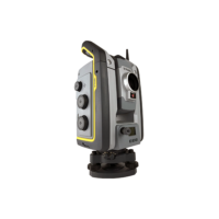
Description
The Trimble S7 Total Station combines scanning, imaging and surveying into one powerful solution. Now you only need one instrument on the job site to perform all your data capture. Create 3D models, high accuracy visual site documentation, point clouds, and more using the Trimble S7, Trimble Access field software and Trimble Business Center office software.
– Surveying, imaging and 3D scanning in one powerful solution
– Improved Trimble VISION technology for video robotic control, scene documentation and photogrametric measurements
– Trimble DR Plus for long range and superior accuracy
– Locate2Protect real-time equipment monitoring and Trimble InSphere equipment management
– Complete field-to-office solution for quick data capture and processing
– Seamless integration with the Trimble V10 Imaging Rover and GNSS receivers
Angular Accuracy: 1″, 2″, 3″, or 5″ available
EDM Technology: DR PLUS
EDM Accuracy: 1.0 mm + 2 ppm Prism / 2.0 mm + 2 ppm DR
Servo: Robotic or Autolock
Maximum Distance Range: 5,500 m DR Plus
Additional Features: VISION
Scanning Speed: 15 points per second
Scanning Range: 250 m
Laser Class and Ingress Protection: Laser Class 2 & IP 65